Off to the starting point
The Schaflegerkogel is a rather exciting hiking goal, that will happily surprise you. Even make you sweat a bit more than anticipated. Who would have guessed that when you have the Kalkkögel right next to yoü Exactly. It’s an easy to medium hike of about 5km in total, that can be completed within 3,5 to 4 hours. Kemater Alm is the starting point to this mountain trail, at 1646m to be exact and you will be hiking up to 2406m. Not to shabby, right? Kemater Alm is quite easy to reach from Innsbruck. Either with a bus or by car. The only downside of the bus is that you walk from Grinzens to the hut, which adds another 5km to your goal! A great thing about this tour, is that it’s also available in winter!

Kemater Alm from above © Paul Pastourmatzis

Kalkkögel view from Kemater Alm © Paul Pastourmatzis

Looking forward to a cold raddler in 4 hours © Paul Pastourmatzis
The way there
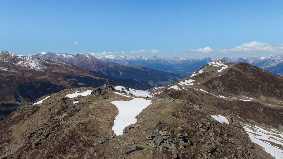
For the longest part of the road, you actually “hike” on a dirt road through the valley, next to river Sendersbach. I would dare to say that this is over half of the entire distance to the top. Naturally, going up seems a lot harder and longer of course. It’s a very scenic route, and while you’re on it you can see the peaks of Kalkkögel to your left, until you reach a wide plateau that looks over the valley. If you’re lucky enough, you might even see some snow. It’s the Alps after all; micro-climate at it’s best. And there it is. At the center of this plateau, the ascension begins. I would suggest a short stop there, for some water. And maybe to mentally prepare yourself and check your gear.

The Nordkette at the end of the valley © Paul Pastourmatzis

On the trail to Schaflegerkogel with my friends © Paul Pastourmatzis

The Sendersbach river from above © Paul Pastourmatzis
Fun, sweat and amazing views
The smallest and last part of this hiking tour is actually straight forward, a very well marked path with signs every now and then. There are parts that can get muddy and potentially slippery at some points, due to the presence of small streams that run down the side of the mountain. Nothing really to worry about, if you are careful enough. And the reason why I am saying that is because the views from up there are simply spectacular. You can see the entirety of the Kalkkögel; the higher you hike, the more you see. Half way to the top you reach a little flat piece of land, and then the trail continues upward, with a satisfying number of turns. And before you know it, you see the cross.

Those amazing views of the Kalkkögel I was talking about © Paul Pastourmatzis

Only a couple of steps more to reach the top © Paul Pastourmatzis

On top of the Schaflegerkogel. It was so worth it © Paul Pastourmatzis
Map Location
Find out more information about hikes in the area, as well as hike trails around Innsbruck.
Show me the location on the map
Similar articles
Who has experienced them, these clear, cold winter nights in the high mountains? Maybe even under a…
The toboggan run from the Rumer Alm is one of my absolute favorite toboggan runs. At just…
When I came to Austria at the age of 16, winter sports were still pretty exotic for…
Snow-covered forests, exercise in the fresh air, enjoying the winter... I am regularly drawn to go outside,…