Off to the starting point
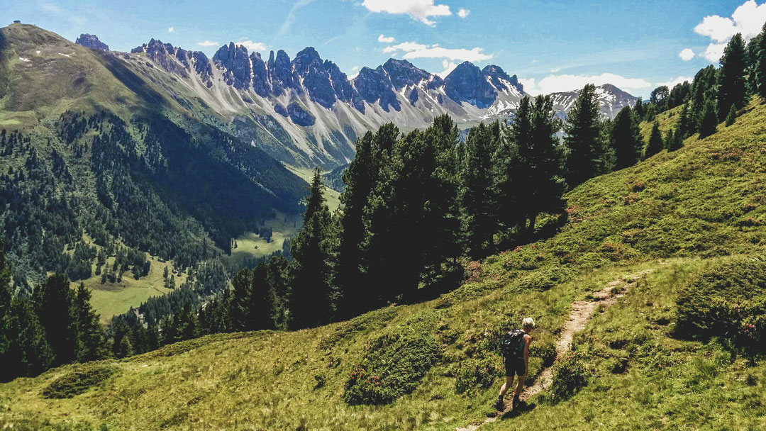
Salfeins and the Salfeinersee are one of the closest hiking trails in Innsbruck. It was the first hike I ever did, when I moved to Innsbruck back in 2012. You can get there by bus or car, there are two huts close to it if you feel like walking a little more (the Kemater Alm and the Adolf Pichler Hütte), and even visit a couple of more peaks while you’re at it (Grieskogel and Breitschwemmkogel). Just get to Grinzens, and head towards the valley between the mountains! It’s dirt road and you would have to pay for a ticket if you drive a car. After a little while, moving along a small river called Sendersbach, you will reach an opening. That’s the parking spot as well as the starting point of the hike.

At the starting point of the Salfeinersee hiking trail © Paul Pastourmatzis
The hike itself is about 4km to go up (8km in total), mainly being on the dirt road. There are a couple of shortcuts tho, where you save in distance and increase effort. I’ve marked them on the map below for you. They are easy to find, since there are signs. If anything, this is the “official” hiking trail so you can mix it up as you go. And if you are lucky enough, you might actually see some wild life up there. Like this deer that I saw last April. There is a chance that you also see snow in spring or autumn or late summer, this is the Alps after all.

One of the shortcuts you can take on your way up © Paul Pastourmatzis

A young deer on the road to Salfeinersee © Paul Pastourmatzis
The way up
One of the most rewarding aspects of this hike (other than reaching the top of course), is the magnificent views of the Kalkkögel. The higher you go, the better it becomes. You can literally take a new photo every 10 minutes and it would look different but still as amazing. I can really do this all day now; thank science for SD cards.
There is a privately owned hut at the end of the dirt road, and that is a good point to make a quick stop. Admire the view, take some photos and drink some water (always stay hydrated during hikes). Now the hike gets interesting, and you will be going up on an uphill hiking trail until you reach the top.

A hut at the end of the dirt road © Paul Pastourmatzis

Perfect view of the Kalkkögel in the distance © Paul Pastourmatzis
Fun, sweat and amazing views
40 minutes later you’re at the top and after the necessary high-fives, you can take in all that alpine nature beauty. Pro Tip: If you are into photography, you can catch a great shot of the Kalkkögel reflected in the water of the Salfeinersee.

Salfeins and a view of the Nordkette and Innsbruck © Paul Pastourmatzis

Salfeinersee with the Kalkögel in the background © Paul Pastourmatzis
And before I go, here’s some more information about hikes in the area, as well as hike trails around Innsbruck.
Show me the location on the map
Similar articles
Who has experienced them, these clear, cold winter nights in the high mountains? Maybe even under a…
The toboggan run from the Rumer Alm is one of my absolute favorite toboggan runs. At just…
When I came to Austria at the age of 16, winter sports were still pretty exotic for…
Snow-covered forests, exercise in the fresh air, enjoying the winter... I am regularly drawn to go outside,…